Top Five Cherokee National Forest Hiking Trails Near Ocoee, TN
Cherokee National Forest stretches across the mountains of eastern Tennessee, and the trails near Ocoee offer some of the most accessible hiking in the region. Within a 15-minute drive of the river, you’ll find waterfall hikes, riverside paths, and ridgeline loops that range from easy strolls to moderate climbs.
This guide covers five of the best trails in the Ocoee River corridor, along with practical details on parking, fees, and what to expect on the ground.
Why Cherokee National Forest Is a Premier Hiking Destination
Cherokee National Forest covers more than 650,000 acres across eastern Tennessee, making it the largest public land area in the state. The forest contains over 700 miles of non-motorized trails, including roughly 150 miles of the Appalachian National Scenic Trail. From gentle waterfall walks to challenging ridge climbs, you’ll find trails for just about every skill level within a short drive of the Ocoee River corridor.
The Ocoee River Gorge sits right in the middle of some of the forest’s most accessible hiking. Trails here wind through hardwood forests, pass cascading waterfalls, and follow ridgelines with long mountain views. Many visitors hike in the morning and raft in the afternoon, turning a single day trip into a full outdoor experience.
What makes this area stand out is the variety packed into a small region. You can walk a flat, family-friendly loop before lunch, then tackle a more rugged riverside trail after. The proximity to the river also means you’re never far from restrooms, parking, or a place to grab food.
Trail Snapshot Comparing Distance, Difficulty, and Features
Before picking a trail, it helps to see how they compare. The table below covers the five trails closest to Ocoee, Tennessee, with the key details at a glance.
| Trail Name | Distance | Difficulty | Route Type | Dogs Allowed | Best For |
| Benton Falls | 3.2 miles | Easy to Moderate | Out-and-back | Yes (leashed) | Waterfall seekers, families |
| Clemmer Trail | 4.0 miles | Moderate | Out-and-back | Yes (leashed) | River views, solitude |
| Azalea Trail | 3.0 miles | Easy | Loop | Yes (leashed) | Wildflowers, beginners |
| Ocoee River Loop | 2.5 miles | Easy | Loop | Yes (leashed) | Quick hikes, scenic overlooks |
| Tanasi Trail System | Varies (up to 12 miles) | Easy to Difficult | Multiple loops | Yes (leashed) | Mountain bikers, longer treks |
Your choice depends on how much time you have and what kind of scenery you’re after. If you want a waterfall, Benton Falls is the clear pick. If you’d rather stay close to the river and watch rafters go by, Clemmer Trail or the Ocoee River Loop will deliver.
 Benton Falls Trail
Benton Falls Trail (Trail No. 131) is the most popular waterfall hike in the Ocoee area. The 1.6-mile path leads to a 65-foot cascade that tumbles over a rock ledge into a shaded pool below. Along the way, you’ll cross several footbridges, and the forest canopy keeps the trail cool even on warm summer days.
The trailhead sits inside Chilhowee Recreation Area, where a day-use parking fee of $5 applies. Arrive early on weekends because this trail draws steady crowds, especially during fall foliage season. The hike typically takes about an hour round trip at a relaxed pace, which makes it a solid choice if you’re planning to raft later in the day.
- Footing near the falls: The rocks around the base can be slippery, particularly after rain. Shoes with good traction help.
- Parking: The lot fills up by mid-morning on Saturdays and Sundays from late September through early November.
- Restrooms: Available at the Chilhowee Recreation Area entrance.
Clemmer Trail
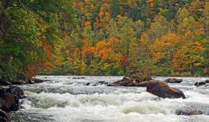
Clemmer Trail follows the Ocoee River for two miles, offering some of the best riverside scenery in the gorge. The path hugs the riverbank, passing through rhododendron thickets and over exposed rock outcrops. You’ll hear the rush of whitewater the entire way, which gives you a preview of what rafters experience on the water.
This trail sees fewer visitors than Benton Falls, so it’s a good pick if you prefer a quieter hike. The terrain is moderately rugged with some uneven footing, though nothing technical. Plan on about two hours for the full out-and-back route.
The trailhead is located off U.S. Highway 64, just a few miles from the Ocoee Whitewater Center. Parking is free, and there are no permits required. On hot days, the shade from the rhododendrons and the breeze off the river make this trail more comfortable than you might expect.
Azalea Trail at Chilhowee 

Azalea Trail loops through the Chilhowee Recreation Area, winding past wildflower meadows and mixed hardwood forest. The three-mile loop is mostly flat, with gentle elevation changes that make it accessible for hikers of all fitness levels. Spring brings the trail’s namesake azaleas into bloom, along with mountain laurel and trillium.
The trail connects to several other paths in the Chilhowee Trail System, so you can extend your hike if you’re feeling ambitious. A picnic area near the trailhead makes this a convenient spot for a post-hike lunch.
Like Benton Falls, Azalea Trail falls within the recreation area’s fee zone. The same $5 day-use pass covers both trails, so you can easily combine them into a longer outing. If you’re visiting in late April or early May, the wildflower display along this loop is worth the trip on its own.
Ocoee River Loop Trail
 Ocoee River Loop Trail
Ocoee River Loop Trail offers a quick, scenic hike right along the river corridor. The 2.5-mile loop starts near the Ocoee Whitewater Center, the same facility built for the 1996 Olympic kayak and canoe slalom events. You’ll pass interpretive signs explaining the river’s history and the engineering behind the Olympic course.
The trail is mostly flat and well-maintained, making it ideal for families with younger children or anyone short on time. Several overlooks provide views of the river’s Class III and IV rapids, so you can watch rafters navigate the same waves you might tackle later.
Parking at the Whitewater Center is free, and restrooms are available on-site. The loop typically takes about an hour to complete. If you’re curious about the Olympic history of the Ocoee, this trail gives you context you won’t find anywhere else in the gorge.
Tanasi Trail System
Tanasi Trail System is the largest network in the immediate Ocoee area, with over 12 miles of interconnected loops. The trails range from easy gravel paths to technical singletrack designed for mountain biking. Hikers share the trails with cyclists, so stay alert and yield to bikes on downhill sections.
The system sits on a forested plateau above the river, with occasional views of the surrounding ridges. You can piece together a short two-mile walk or link multiple loops for a half-day adventure. Trail markers are well-placed, though carrying a map or downloading the route to your phone is a smart idea since cell service can be spotty.
- Access: Free to use with no parking pass required.
- Trailhead location: Off Forest Service Road 77, about 10 minutes from the Ocoee Whitewater Center.
- Shared use: Mountain bikers frequent the singletrack sections, especially on weekends.
Know Before You Go With Parking, Fees, and Trail Conditions
A little planning goes a long way when hiking in Cherokee National Forest. Here’s what to keep in mind before you head out.
- Parking fees: Chilhowee Recreation Area charges $5 per vehicle for day use. Trails outside the recreation area (Clemmer, Tanasi, Ocoee River Loop) are free.
- Trail conditions: Most trails are open year-round, though winter ice can make rocky sections hazardous. The U.S. Forest Service website lists current closures and alerts.
- Cell service: Coverage is spotty throughout the gorge. Download maps before you arrive.
- Wildlife: Black bears live in Cherokee National Forest. Store food properly and make noise on the trail to avoid surprising them.
- Water: Bring your own. Streams are plentiful, but you’ll want a filter if you plan to drink from natural sources.
Restrooms are available at Chilhowee Recreation Area and the Ocoee Whitewater Center. Other trailheads have limited or no facilities, so plan accordingly.
Pairing a Hike With a Day on the Ocoee River
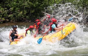
Many visitors find that a morning hike pairs well with an afternoon rafting trip. The trails near Ocoee are short enough to finish before lunch, leaving plenty of time to hit the river. Quest Expeditions offers half-day and full-day trips on the Ocoee, including runs through the 1996 Olympic course.
A full-day trip includes a riverside lunch, so you can refuel between adventures. Groups traveling from Chattanooga, Atlanta, Knoxville, or Nashville often make a weekend of it, combining hiking, rafting, and exploring the nearby towns.
If you’re looking to turn your Cherokee National Forest visit into a complete outdoor experience, reach out to our team to plan your trip.
Frequently Asked Questions
What are the easiest hikes in Cherokee National Forest near Ocoee?
Azalea Trail and Ocoee River Loop Trail are the most beginner-friendly options. Both are relatively flat, well-marked, and under three miles in length. Families with young children often start with one of these two before trying something longer.
Is Benton Falls Trail dog-friendly?
Yes. Dogs are welcome on Benton Falls Trail as long as they remain on a leash. The same policy applies to all trails in Cherokee National Forest. Bring water for your dog, especially in summer, since the trail can get warm despite the tree cover.
Are there bears in Cherokee National Forest?
Black bears are present throughout the forest. Encounters are uncommon, but you can reduce risk by storing food securely, keeping a clean campsite, and making noise while hiking. If you see a bear, give it space and don’t approach.
Do I have to pay to park at every trailhead?
No. Only trails within Chilhowee Recreation Area (Benton Falls, Azalea Trail) require a $5 day-use fee. Clemmer Trail, Tanasi Trail System, and Ocoee River Loop Trail have free parking.
How long is the hike to Benton Falls?
The trail is 1.6 miles one way, making the round trip 3.2 miles. Most hikers complete it in about an hour at a comfortable pace.